When Scientists Scanned A Jungle With Light Waves, They Discovered A Monumental Mayan Secret
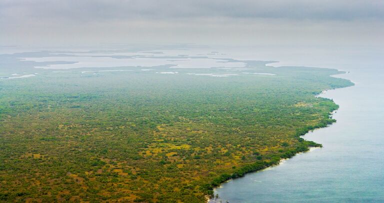
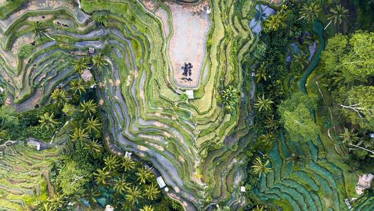
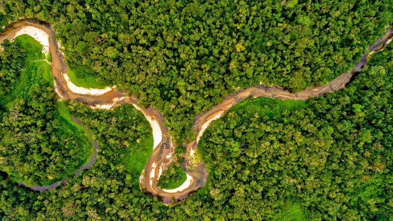
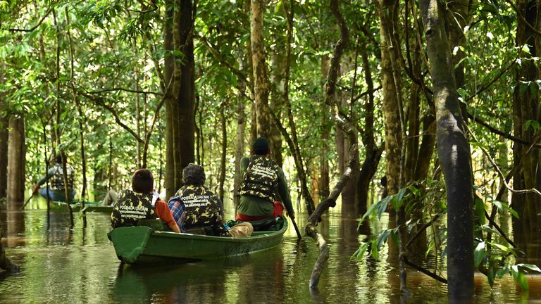
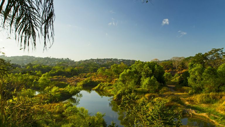
High above the canopy of a Belize wetland, researchers hover as they gather data about the earth below. And while the team can’t see through the leaves to the ground, the laser beams that they fire from their aircraft certainly can. Then, as the light bounces back up, it reveals a monumental secret — one about the ancient Maya people who once roamed here.
Seeing things differently
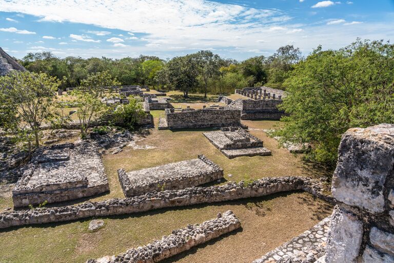
Yes, many centuries ago, the Maya dwelled in the Birds of Paradise wetlands. And the marsh — which covers two square miles or so — has actually been extensively studied by experts for decades. Now, though, modern technology allowed researchers to see this swathe of land as they never had before.
Lost to time
And for those specializing in the Maya, this advancement proved crucial. After all, the civilization had long since crumbled, with the last Maya city having fallen in 1697. Many of the people’s artifacts faded away with them, too — or so we had long thought. But in 2019, researchers discovered otherwise.
Vast empire
So, who exactly were the Maya? Well, while hunter-gatherers once roamed Central America, the Preclassic period — which extended from 1800 B.C. to 250 A.D. — saw these wanderers put down roots. Among these people were the Maya, who began to build cities across the region. And, ultimately, they inhabited all of modern-day Belize and Guatemala as well as parts of Mexico, Honduras, and El Salvador.
Reaching their peak
Then, between 250 A.D. and 900 A.D., the Maya hit the peak of their influence, with their rise to the top more or less unmatched. In his 2011 book The Maya, Yale professor Michael Coe explained how the civilization “reached intellectual and artistic heights which no other in the New World — and few in Europe — could match at the time.”
Mathematicians and astronomers
Among the Maya’s triumphs were their advances in both astronomy and math. For one thing, they created a calendar system that had 365 days in a year — a number we have obviously since found to be accurate. These ancient people also used zero in their calculations, making them only the second civilization in history to do so. The Maya had discovered the figure separately from the Mesopotamians, who had first used zero in about 4 B.C.
Switching styles
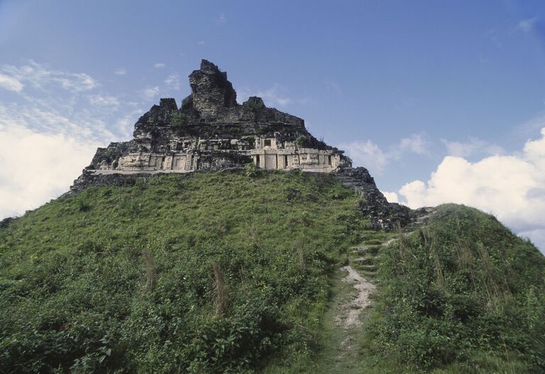
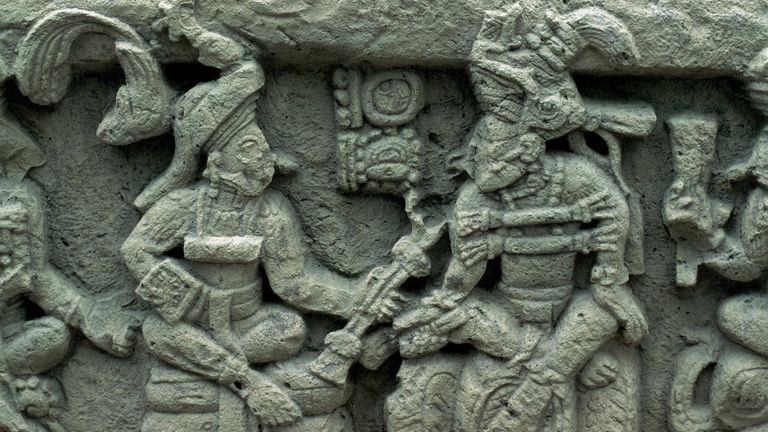
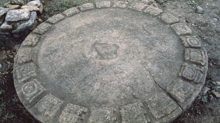
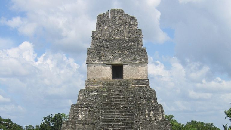
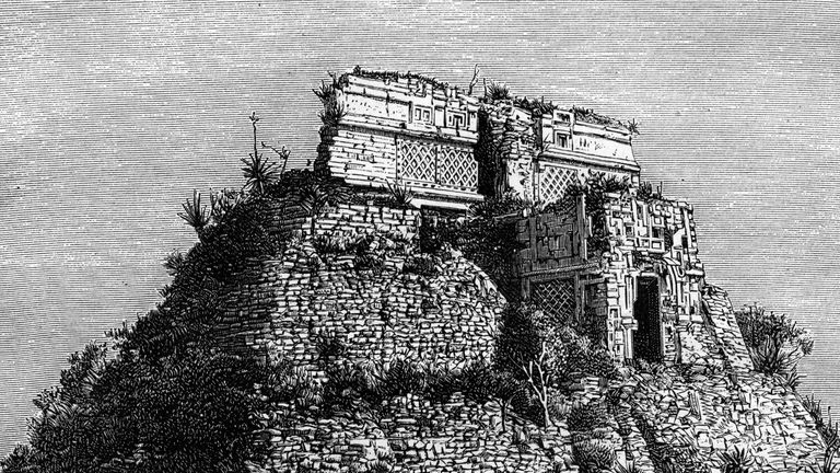
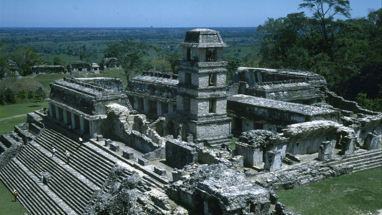
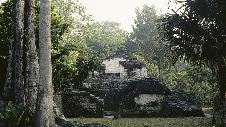
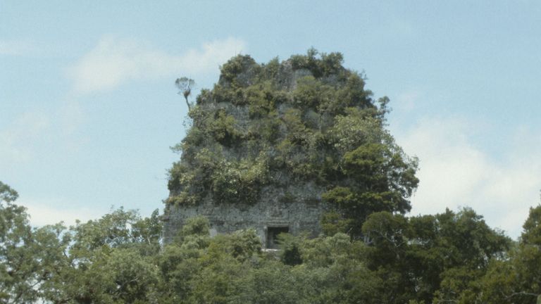
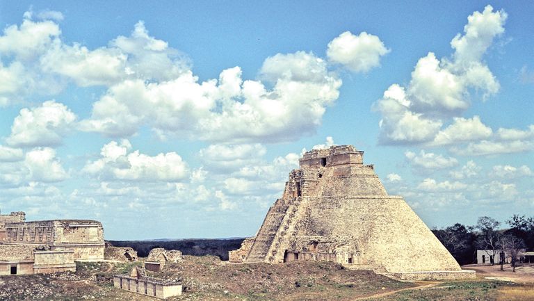
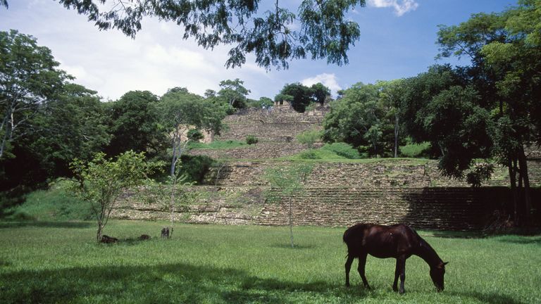
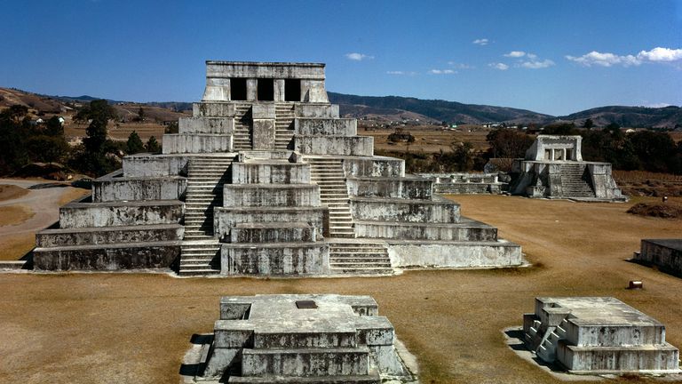
Then there were the Maya’s advancements in art and architecture. Some of their creations still stand today, in fact. And, interestingly, each Maya city seems to have had its own signature style of construction. Tikal mastered the art of pyramid-building, for example, and leaders there would order a new one to be built every 20 years.
Writing system
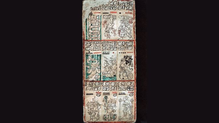
On top of that, the Maya devised a system of hieroglyphic writing. Historians began to decipher this form of text in the mid-1900s, meaning there is now some understanding of the inscriptions left behind in Maya art and sculpture. Books were also made out of tree bark, rubber, and chocolate, and so far experts have their hands on four such volumes.
Not like the rest
Finally, the Maya flourished in areas unlike those belonging to any other long-ago civilization. Most of the time, ancient peoples gathered on arid lands and diverted water flow to their cities and villages; the Maya, by contrast, had no need for such infrastructure, as they had settled in lowlands. In his book, Coe claimed that the Maya instead developed “really effective farming” practices — as evidenced by their “densely inhabited villages.”
End of the Maya
In spite of all their achievements, though, the Maya left their lowlands between the eighth and ninth centuries. And while the people didn’t record their reasons for disappearing in their ancient tree-bark texts, scholars have their own suspicions about what happened. It’s been said, for example, that the Maya simply ran out of resources to support their massive cities; elsewhere, it’s been posited that conflict with other civilizations was to blame.
Limited information
Nevertheless, some descendants of the Maya reside in their ancestors’ former territory, with most calling Guatemala their home. In the meantime, experts continue to study these people’s ancient family members — despite the lack of resources available. As previously mentioned, researchers have long had only those four Maya texts, art, and sculptures to go on.
No easy access
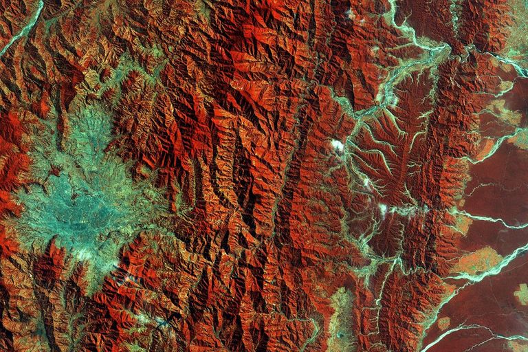
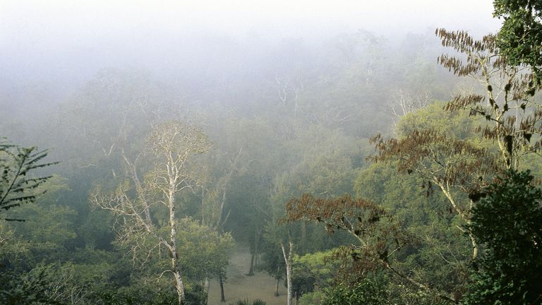
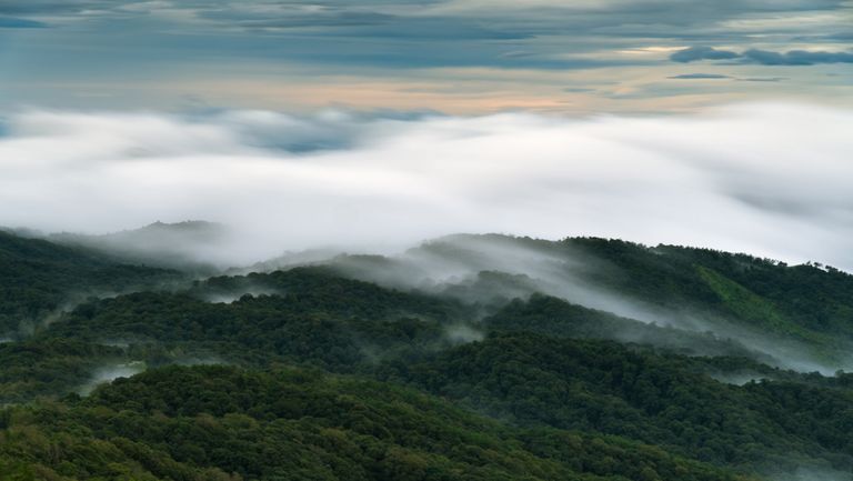
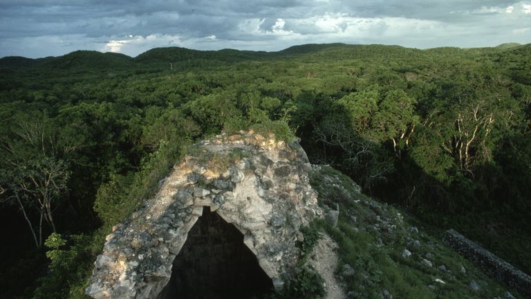
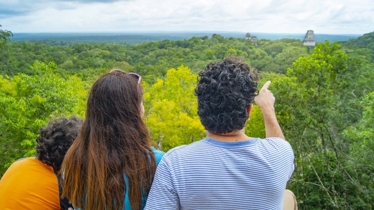
Finding more about the Maya isn’t simply achievable by excavating their old stomping grounds, either, as much of their former territory now hides beneath thick jungle foliage. As a result, archaeologists have had to trek to former Maya cities and villages and spend years mapping them. Still, that may all change, as technology is revolutionizing the way that Maya specialists can uncover the secrets of these lands.
LiDAR
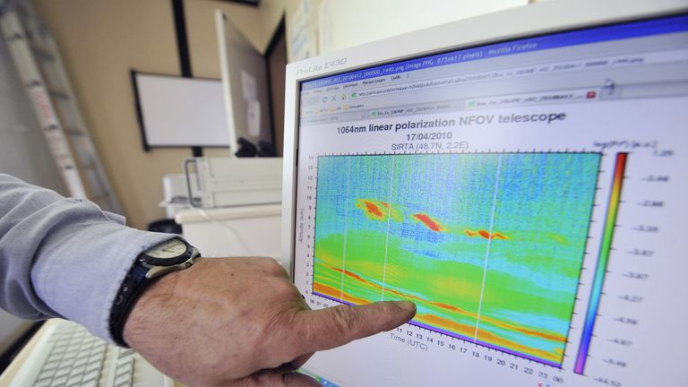
In particular, scientists and archaeologists now have LiDAR — light detection and ranging — on their side. This technology emits pulsed laser light that can then be used to calculate the distance to the Earth’s surface. During this process, the system also gathers further information to paint a picture of what the terrain looks like below.
A new means of exploration
Understandably, then, LiDAR capabilities have been installed in airplanes and helicopters so that experts can gather data over sweeping stretches of the Earth. And the technology can be used over both water and terrain; green light scopes out seabeds, while infrared laser beams can create topographical maps.

The mission begins
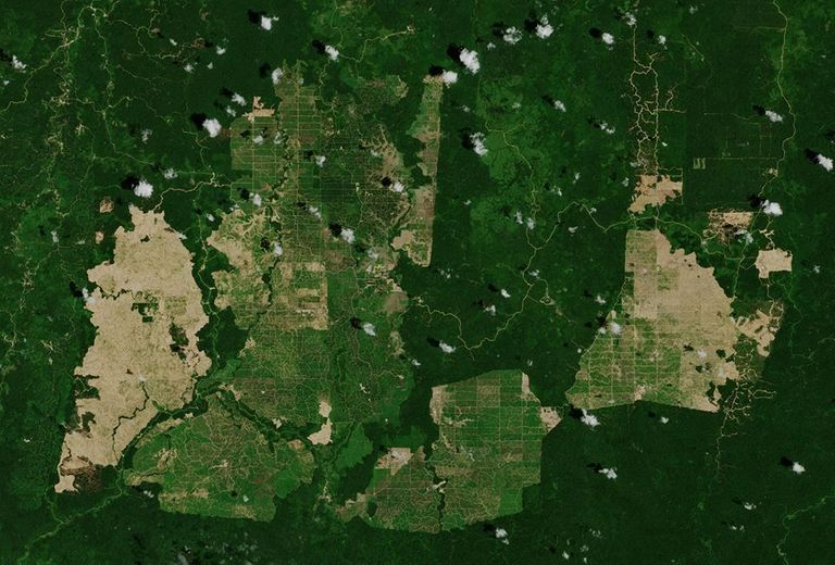
So, in 2018, researchers used this technology to uncover new information about the Maya. The team jetted over a one-time Maya stronghold in the lowlands of Guatemala, flying above the same land again and again in order to find what lay beneath the thick canopy of foliage.
A technical process
And LiDAR gave the group the ability to map the ground — even to capture the outlines of features a mere yard in size. Laser beams slipped through the gaps between jungle trees and traveled down to the earth before returning data to the specialists. Knowing how long it took for the light to hit the ground and bounce back also gave the team an idea of the ground’s elevation.
Extensive project
What’s more, this particular project was extensive, with the scientists examining more than 770 square miles of former Maya lands. According to Eos, this constituted “the largest single LiDAR survey of Mesoamerican technology.” And the group’s findings ultimately uncovered a lot of new information about the everyday lives of the people who made up this ancient civilization.
Uncovering metropolises
Broadly, the researchers found a stunning number of Maya structures in this stretch of the Guatemalan jungle — more than 61,000, to be exact. And they didn’t discover find the shells of ancient buildings, either. Yes, LiDAR also revealed roads that may have connected outlying areas to city centers — suggesting that these metropolises were more important than previously believed.
Larger than they thought
The roads — along with other remnants such as homes and gardens — also told the researchers that this particular settlement had been much larger than they had thought. After some recalculations, the team then realized that hundreds of people would have fit into every square mile of this community just north of Tikal.
Hello, neighbor
In 2018, study co-author Thomas Garrison explained to Discover magazine, “In certain parts of these areas… every little rise and hillock in the landscape has a family living on it, extending for miles outside of places like Tikal. When you step out of your house in the morning, you look out [and] you’re seeing all of your neighbors right there. Everyone’s right on top of each other.”

Huge population
Consequently, the LiDAR-based findings pushed estimates of the Maya population’s size to new limits. Some have suggested that, during its peak, the civilization counted ten million people among its ranks. And while it’s impossible to calculate an exact number, the experts have agreed that the Maya dominated the lands they had inspected with LiDAR.
Varied findings
Other areas of Maya territory have yielded less information for researchers, however. While the north-of-Tikal settlement had plenty of buildings and signs of human innovation such as roadways and agriculture, areas with more fields than buildings were also uncovered. Purely urban zones appeared during the searches, too.
Complex society
Yet this variation pointed to the complexity of Maya society, according to study co-author Marcello Canuto. Speaking to Discover, he revealed, “Like any map that you see of any modern nation or any populated ancient context or modern context, you’re going to have places where people congregate — and people live more closely together and are more dense — and places where they don’t.”
A long way to go
Given the wide swathe of land once held by the Maya, though, researchers have plenty of work to do in examining it all. Specialist Francisco Estrada-Belli explained it best to National Geographic in 2018, saying that LiDAR was “revolutionizing archaeology the way the Hubble Space Telescope revolutionized astronomy.” Even so, the sheer wealth of information the technology provides means experts would “need 100 years to go through all [the data] and really understand what [they were] seeing.”

More discoveries
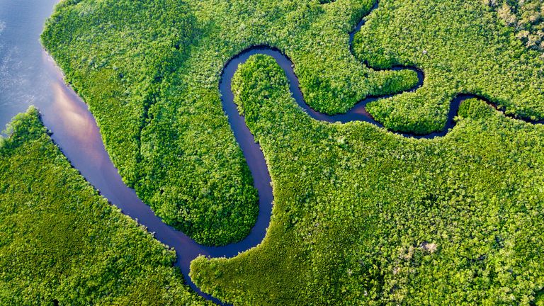
In the interim, LiDAR has continued to uncover more secrets of the Maya civilization. And when the apparatus was used on Belize’s Birds of Paradise wetlands, it revealed yet another surprising facet of life as the jungle-based population knew it. Namely, researchers revealed in 2019 that they had found an extensive series of fields and canals beneath the canopy.
Farmland
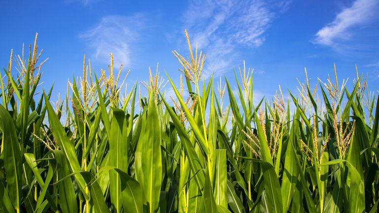
This space once played host to the crops the Maya used to feed their massive population — maize, avocado, and arrowroot among them. And the study also uncovered when, precisely, the Maya had farmed these grounds; apparently, their Belize-based agricultural pursuits had taken place between 1,800 and 900 years ago.
Distinct areas
Researchers had previously known that the Maya had farmed and that this region of Belize had once been used to grow crops. After LiDAR worked its magic, however, it revealed four distinct agricultural areas — one of which was actually much larger than previously thought. And experts didn’t actually know about one of these locations at all until the LiDAR results bounced back to them.
Backing up their findings
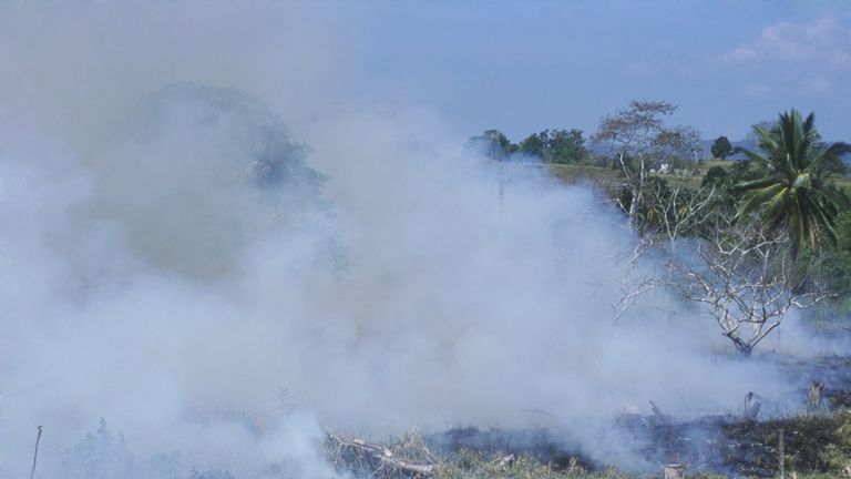
Then, although LiDAR produces a surprisingly accurate picture of the ground below, the researchers attempted to back up their digitized findings with ground research. And, fortunately, the team were able to corroborate the data using evidence that they found hidden in the terrain. For instance, there was ancient ash, which suggested that the Maya had burnt their fields before replanting them.
Environmental impact
The group also excavated the ancient canals that they had scoped from above and went on to perform radiocarbon dating of the soil they had collected. And this portion of the project revealed yet another interesting truth. Even without the use of any of the chemicals and mass production methods of today, the Maya’s ancient farming methods had seemingly adversely affected the environment.

Unintentional destruction
According to Eos, lead author Tim Beach revealed that the Belize LiDAR project revealed “early and extensive human impacts on the global tropics.” You see, the Maya had transformed wetlands into fruitful farmland, not knowing that they may have created both methane and carbon dioxide emissions in doing so.
The first to do it
Shockingly, then, the Maya civilization may have been one of the world’s first human sources of greenhouse gas emissions. At the very least, their crops affected the soil in their fields. Specifically, higher isotope levels indicate maize growth in the area as well as other crops that humans would have cultivated at the time.
Understanding the impact
And considering the massive scale of Maya farming — which researchers finally grasped thanks to LiDAR — the ancient people may have produced carbon dioxide and methane in the process. This in turn paints a new picture of climate change, Beach explained. In a University of Texas at Austin press release, the scientist added, “We now are beginning to understand the full human imprint of the Anthropocene in tropical forests.”
Earlier climate change
Beach continued, “These large and complex wetland networks may have changed climate long before industrialization, and these may be the answer to the long-standing question of how a great rainforest civilization fed itself.” The LiDAR revealed, too, that the Maya may actually have had trouble in growing enough produce.
Adapting to the environment
For one, the ancient people had to contend with the rising sea levels that crept up over a 2,000-year period. In addition, they had droughts to worry about, with these dry periods having taken place around 1,200 to 900 years ago. And this tells exactly why the Maya dwelled in wetlands; that way, they could engineer canals to suit their water needs.
Balancing act
These efforts made Maya settlements much less primitive than one might think. Instead, as study co-author Sherly Luzzadder-Beach has explained in a 2019 University of Texas at Austin press release, “These perennial wetlands were very attractive during the severe Maya droughts, but the Maya also had to be careful with water quality to maintain productivity and human health.”
High methane levels
What the Maya may not have known, though, was that their activities were hurting the planet. As they expanded their wetland fields to feed their large population, they created carbon dioxide when they burned plants. The people also boosted methane levels to the highest that they would reach until the modern era rolled around.
Not the only ones
Yet the Maya weren’t the only ones producing methane; ancient civilizations in China and South America did so as well. And Beach has emphasized the harmful effects of these actions, saying, “Even these small changes may have warmed the planet, which provides a sobering perspective for the order-of-magnitude-greater changes over the last century that are accelerating into the future.”

Scratching the surface
Perhaps even more surprisingly, though, the specialists have only just scratched the surface when it comes to the Maya’s effects on their environment. The ancient people may in fact have used even more of the Central American wetlands than experts have yet found, and so LiDAR could be deployed in the future to explore this possibility.

Global role
And while people knew how innovative and important the Maya civilization had been even before these discoveries, we could still learn more. You see, the new finds point to the Maya as having had a global — not just a Central American — role to play during their time.
Linking the past and the present
Beach concluded, “Understanding agricultural subsistence is vital for understanding past complex societies and how they affected the world we live in today.” So, research into the Maya’s lands will have to continue to paint that full picture — and clarify further those connections between the people of the past and the present.