Researchers Have Finally Confirmed The Truth About Infamous ‘Viking’ Map Of America

The map is a secret, and only a small team of scholars are allowed to study it. After all, if what they have been told is true, this document could change history. Then, eventually, they announce their findings to the world — sparking a debate that has only finally been solved after more than 50 years.
An astonishing find
Back in 1965, representatives from Yale University revealed that astonishing find: a map of the North American coast, apparently drawn decades before Columbus made his fateful voyage. Was this evidence that other civilizations had reached the region long before the explorer even set sail? Or was there something else at play?

The Vinland Map
For decades, academics and amateurs alike have debated the strange case of the so-called Vinland Map. To some, it was proof that the Vikings were the first Europeans in America, beating Columbus to the punch by half a century or more. But to others, it was merely a forgery, perhaps created to boost the reputation — and the bank balance — of a struggling nation.

The shocking truth
As the debate raged on, though, a group of researchers decided to solve the mystery once and for all. Using the latest technology, they studied every inch of the Vinland Map, looking closely at the ink used to create the controversial image. And, now, they are finally ready to announce the shocking truth.

Columbus sailed the ocean blue
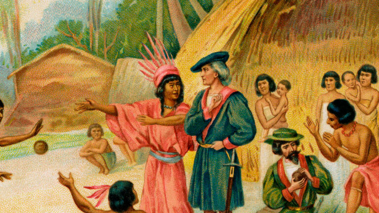
If the map turned out to be real, then teachers all over the U.S. would have to rip up their lesson plans. The popular story is that, in August 1492, Columbus sailed across the Atlantic in search of new lands. Then, two months later, he landed in the Bahamas, kickstarting a new era in history and the beginning of the end for the indigenous way of life.

Was he really the first?
Even today, many people refer to these events as the “discovery” of North America – despite the fact that there were indigenous communities thriving on the continent at the time. But recently, many have begun to question this narrative and the way in which it is taught. In fact, there’s evidence to suggest Columbus wasn’t even the first person from Europe to make it to these far-flung shores.
The mighty Leif Erikson
So if Columbus wasn’t a pioneer, who was? Well, in ancient Norse chronicles, there are references to a region known as Vinland, believed to be located somewhere in North America. And according to legend, the explorer Leif Erikson traveled there in approximately 1000 A.D. — almost 500 years before his Italian counterpart.

The Canadian evidence
For years, it was speculated that Vinland was located somewhere on America’s east coast. But in 1960 a pair of Norwegian archaeologists began investigating a site at L’Anse aux Meadows in Newfoundland, Canada. There, reports claim, they were shown a series of mounds that the residents referred to as an “old Indian camp.”

A Norse settlement in North America
But this was no Indian camp. On closer inspection, the archaeologists came to the conclusion that the mounds were actually the remains of a Norse settlement — the only verified one of its kind in North America. At last, there was evidence to prove what many had long suspected: that the Vikings, not Columbus, were the first Europeans to cross the Atlantic.

A strange map
But as the world adjusted to this news, another shocking story was developing behind the scenes. In 1957 a strange map had begun circulating in certain circles. Collected together with a medieval document called the Tartar Relation, it appeared to date from the 15th century. Its content was anything but irrelevant, mind you.

Finding Vinland
Drawn on apparently ancient parchment, the map shows various regions of the world, including Asia, Europe, and Africa. What really caused a stir, though, was its depiction of a large chunk of land not too far from Greenland. Labeled Vinland, this region was, according to the document itself, first explored by 11th-century Europeans.

It looked like compelling evidence
At the time, the settlement at L’Anse aux Meadows was still a few years away from being uncovered. This map, then, must have seemed among the most compelling pieces of evidence to support the theory of Vinland and the Viking explorers. But was there more to the bizarre document than met the eye?

The first seeds of doubt
From the beginning, there were some who doubted the authenticity of what became known as the Vinland Map. After all, the wormholes in the parchment did not appear to be in the same places as in the copy of the Tartar Relation. That suggested the two had been bound together at a later date. But even so, the document and its accompanying map were snapped up by a dealer. He then attempted to sell the artifact to Yale University.

An intriguing discovery
At first, folks at the Ivy were reluctant to take the dealer up on his offer. Then another medieval text emerged. This was a copy of Speculum Historiale, a work by the Dominican monk Vincent of Beauvais. And, apparently, the wormholes in the volume suggested that this, the Tartar Relation, and the Vinland Map had all initially been bound together.

Announced to the world
Convinced that the Vinland Map was worthy of further study, philanthropist and Yale grad Paul Mellon purchased the document and gave it to his alma mater. And on October 11, 1965 — so, just before Columbus Day — the discovery was finally made public. A tie-in book was published about the find at the same time, too.

Academic scrutiny
By that time, news of the Norse settlement at L’Anse aux Meadows had spread around the world. And the Vinland Map seemed only to strengthen the argument that the Vikings really had reached North America in the 11th century. But it wasn’t long before some academics began to cast doubt on the authenticity of the document.

The Greenland problem
One of the problems, it seems, was how the Vinland Map depicted the colony of Greenland. Specifically, it was almost too accurate to be believed. Back in the 15th century, when the document was allegedly compiled, the region was typically shown as a peninsula — rather than the island we know it to be today.

Hard to believe
“Greenland is so close to the real Greenland, it’s hard to believe anyone in the Middle Ages would have drawn a map like that,” Norse studies expert Gisli Sigurdsson told The New York Times in September 2021. And that wasn’t all. Basically, the Vikings were not exactly known for making maps.

Inexperienced map-makers
Instead, the Norse explorers are believed to have navigated using knowledge that was handed down the generations. In fact, the Vinland Map, if authentic, would be the only verified example of such a Viking-era document. How, then, could these inexperienced cartographers have created something so staggeringly exact?

Crumbling ink
Over time, some scholars also pointed out that the materials used to create the map were behaving in unexpected ways. Apparently, the ink was disintegrating in a manner not seen in any other medieval documents to date. Then, in 1972, chemical analysis revealed something startling.

The giveaway?
These tests suggested that the ink contained a version of titanium dioxide. However, that particular type of the pigment was not actually used in ink until 1917. Ultimately, then, Yale officials were forced to admit that the map may not be as genuine as it had first appeared. But there would be a twist in the tale.

The twist
In 1987 a group of researchers at the University of California claimed that the map could well be the real deal. Using modern technology, they studied the parchment and concluded that titanium dioxide was only present in very small amounts. In other words, there was nothing concrete to suggest that the document was created using 20th-century ink.

A German forgery?
As the years passed, numerous scholars spoke out both in favor of and against the mysterious Vinland Map. In 2002 Kirsten A. Seaver, an amateur historian, even claimed that the document was forged by a German man in a deliberate attempt to insult the ruling Nazi party. But no definitive conclusions were ever reached — until recently.

The latest investigation
So, what’s the real story behind the Vinland Map? Is it a clever fake, designed to promote the now-widely accepted view that Vikings reached North America first? Or is it completely authentic? Researchers at Yale have returned to the map equipped with modern analytical technology, and they’ve finally come to an astonishing conclusion.

Denounced as a forgery
In September 2021 Yale released a statement revealing what many had believed all along: that the Vinland Map is a forgery. How do we know this? It’s all down to the work of Paula Zyats and Marie-France Lemay — two academics who specialize in old texts. Together with a group from Yale’s Institute for the Preservation of Cultural Heritage, they set out to unravel the mystery once and for all.

Unprecedented access
Previously, Yale had only granted limited contact with the Vinland Map. This team, though, were given all the time they needed to analyze the document and speak with people closely involved in its history. And as well as the controversial text itself, they were also able to examine the accompanying copies of the Tartar Relation and Speculum Historiale.

Back to the wormholes
“Studying the three objects together is important to learning their full story,” Zyats explained in the Yale statement. By looking at the wormhole patterns, the specialists were able to deduce that the Vinland Map had initially been bound together with Speculum Historiale. And thanks to earlier radiocarbon dating, they already knew that the copies of both Speculum Historiale and the Tartar Relation were genuine 15th-century relics.

Radiocarbon dating
Previously, researchers had also conducted radiocarbon dating on the map itself, and it had also appeared to come from the same era. But the team knew that the age of the parchment did not necessarily guarantee the age of the ink. And so they used a technique known as X-ray fluorescence spectroscopy, or XRF, to take a closer look.

The deepest insight yet
For years, researchers have employed this technique to look at the make-up of three-dimensional objects. But the ability to apply it to two-dimensional surfaces is a relatively new development. In the statement from Yale, the Technical Studies Laboratory’s Anikó Bezur explained how this advancement gave us the deepest insight yet into the Vinland Map.

The big picture
“With macro-XRF, we can generate a one-to-one scale elemental map of the map,” Bezur revealed. “That’s huge because it allows us to share a full dataset of the entire map. We’re not picking and choosing individual points. We’re offering the big picture.” And this big picture, it turns out, pointed overwhelmingly towards fraud.

Down to the ink
According to the Yale statement, medieval texts were usually created using iron gall ink. This was a substance containing iron sulfate and crushed-up gall nuts. But the XRF analysis revealed that these elements were barely detectable in the Vinland Map. Not only that, but it also confirmed that there was a substantial amount of titanium dioxide.

Confirming their suspicions
What’s more, the team discovered some barium, suggesting that the ink was one of the early titanium pigments released in the 1920s. Certainly, it was seeming more and more likely that the map was a modern forgery. But just to be sure, the researchers investigated the elements present in around 50 genuine medieval manuscripts.

A 20th-century fraud
Just as they had suspected, the team found less titanium and more iron in each of the manuscripts. By that point, the conclusion was clear: the Vinland Map was created in the 20th century. But some questions still remained. Did someone deliberately forge the document? And if so, why?

The small details
Of course, it’s possible that the creator of the Vinland Map didn’t intend to deceive anyone. Maybe any alleged historical significance was faked at a later date. But according to the Yale statement, the team found evidence that this was not the case. On the back of the map, you see, researchers uncovered a seemingly authentic inscription written in Latin.

Bookbinder’s notes
This inscription could well have been part of the original bookbinder’s notes, containing instructions on how to put together Speculum Historiale. But the iron gall ink had been written over more recently to make it look as if the Vinland Map had always been bound alongside the real manuscript.

Motive to deceive
“I think that constitutes pretty strong evidence of a motive to deceive — to make the map look like something it is not,” Richard Hark, a conservation expert at Yale, explained in the statement. But if the document that has divided the world for decades is a deliberate forgery, then who was behind it?

European propaganda
According to map specialist Dale Kedwards, the Vinland Map could have been part of a propaganda campaign designed to boost colonial power. Speaking to The New York Times, he said, “[It] is just one in a long series of forgeries that are about demonstrating a European presence on American soil. It’s used to undermine Indigenous First Nations history and is tied with the kind of partisan, nationalist historiography that develops in Europe.”

Doing it for Norway?
And the University of Cambridge’s Elizabeth Ashman Rowe, who specializes in Scandinavian history, agrees. According to her, the map may have been created by someone with “a desire to enhance the international importance of Viking Age exploits at a time when Norway was one of the most impoverished countries in Europe.”

Let’s move on
Now, though, the document has finally been exposed as a fake — and academics are keen to move on. In the statement, Yale curator Raymond Clemens explained, “Objects like the Vinland Map soak up a lot of intellectual air space. We don’t want this to continue to be a controversy. There are so many fun and fascinating things that we ought to be examining that can actually tell us something about exploration and travel in the medieval world.”

A home at Yale
What will happen next? Well, according to the statement, the document won’t be leaving Yale any time soon. Clemens continued, “The map has become a historical object in and of itself. It’s a great example of a forgery that had an international impact. And it’s an integral part of the Speculum Historiale, which is a genuinely fascinating manuscript.”
